Scenic Drives in and around Ouray
Nestled in the heart of the San Juan Mountains in southwest Colorado, Ouray is a charming small town renowned for its breathtaking natural scenery and outdoor recreation opportunities. With its rugged peaks, deep canyons, and picturesque valleys, the area surrounding Ouray offers some of the most stunning vistas in the American West.
One of the best ways to experience the beauty of this region is by taking a scenic drive, which allows visitors to explore the stunning landscapes at their own pace. From winding mountain roads to peaceful valley routes, there are numerous scenic drives in and around Ouray that offer unforgettable views and unforgettable experiences.
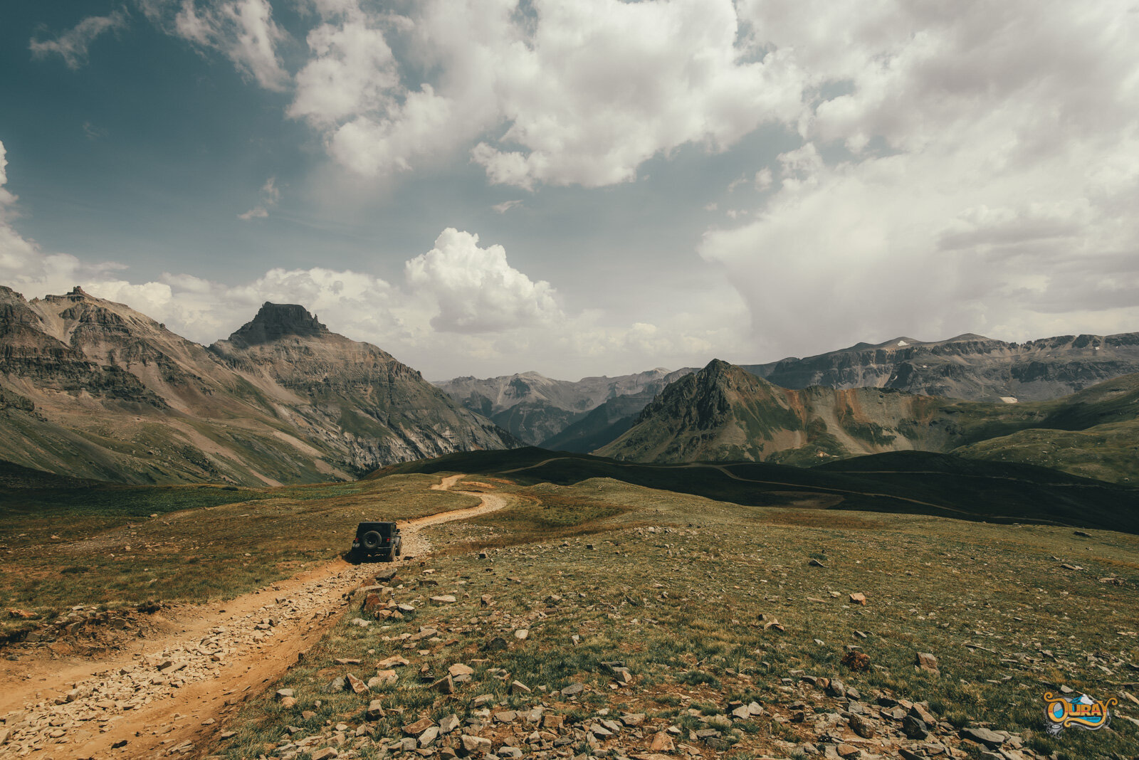
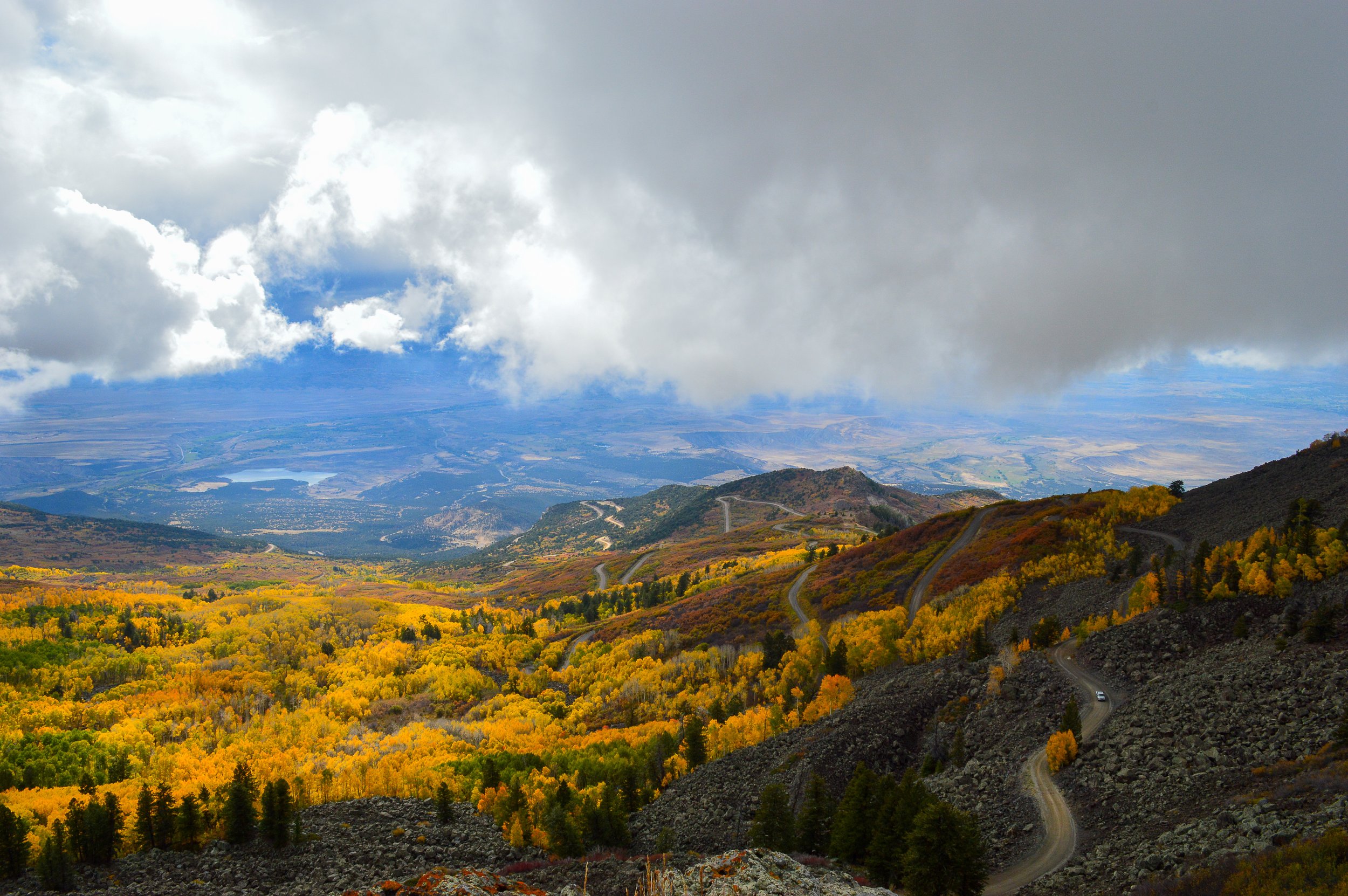
Owl Creek Pass
This is a great half-day excursion. Be sure to plan a picnic lunch to take and enjoy just at the crest of the pass beside the stream. The road is a compact dirt surface which can get "washboard”-y in places. There is usually wildlife on this drive. Some guests enjoy this trip in the late afternoon when the deer are grazing.
Turn right 2 miles north of Ridgway onto County Road 10 when you see the highway sign reading Owl Creek Pass and Silver Jack Reservoir. The road crosses several large ranches with forks in the road. Continue to follow the signs saying Owl Creek Pass.
After entering the national forest area, you will drive past Chimney Peak off to the right. You might also recognize other sights from the movie True Grit, which was filmed in this area. As you approach the pass, watch for a beautiful meadow on your left surrounded by aspen trees. This is the location where John Wayne and the "bad guys" rode their horses directly toward each other, firing their guns at the end of the movie.
From the pass, you can continue on to the Silver Jack Reservoir where they have some good lake fishing. Be sure to follow the signs taking the left fork immediately beyond the pass.
ROUND TRIP TIME: You can easily spend a half-day in this area if you go all the way to the reservoir. If you just drive to the pass and back, without much stop time, it would take approximately 2 hours.
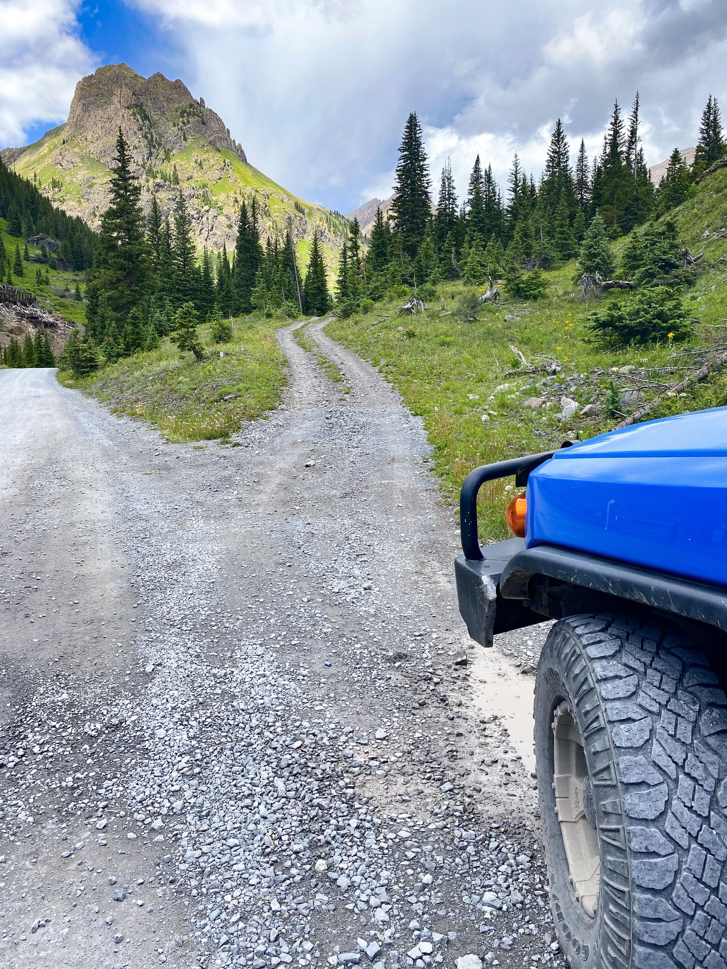
Camp Bird Road
The road to the famous Camp Bird Mine is a compacted dirt surface leading back into an area that was heavily mined for gold and silver.
Immediately south of Ouray, just past the first switchback on Hwy 550, turn right at the sign for Box Canyon Falls and, at the immediate "Y" in the road, continue left. Follow the Yankee Boy Basin sign. Most cars can manage this road as far as the Camp Bird Mine, approximately 5 miles. It is not suitable for cars with low clearance or low profile tires. Do not attempt to drive much beyond Camp Bird. The road doesn't look bad but it can turn rugged quickly.
There is plenty of space to turn around at the Camp Bird junction. Some guests like to park their car and hike the remaining 3 miles into the Yankee Boy Basin. Be sure to pull your car completely off the road in a safe place where it is out of the way of traffic.
Take a picnic. There are some great places to stop and enjoy a meal.
ROUND TRIP TIME: Round-trip driving time, without long stops, should be about 1 hour. This does allow time for photos.
**This is a one lane road with a lot of traffic including heavy equipment and large trucks. Please pay attention and share the road. Do not attempt unless you are prepared to back up if necessary to allow traffic to pass. Traffic traveling in the uphill direction generally has the right of way, but State Law requires that if vehicles cannot pass on a narrow road, whichever vehicle can more readily back up must do so, and that may be a smaller vehicle traveling uphill. **
Short Excursions

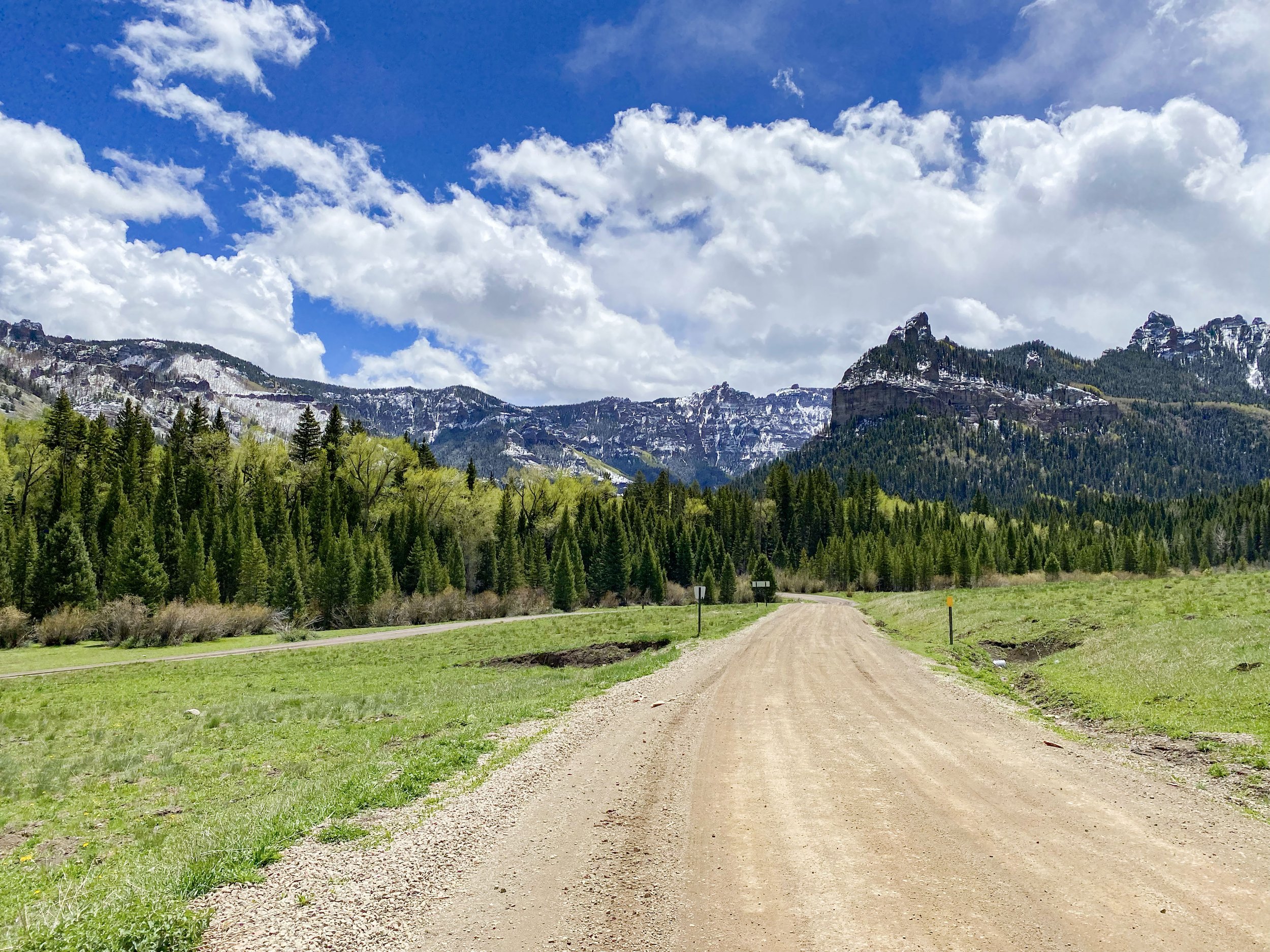
Ouray to Silverton & Return
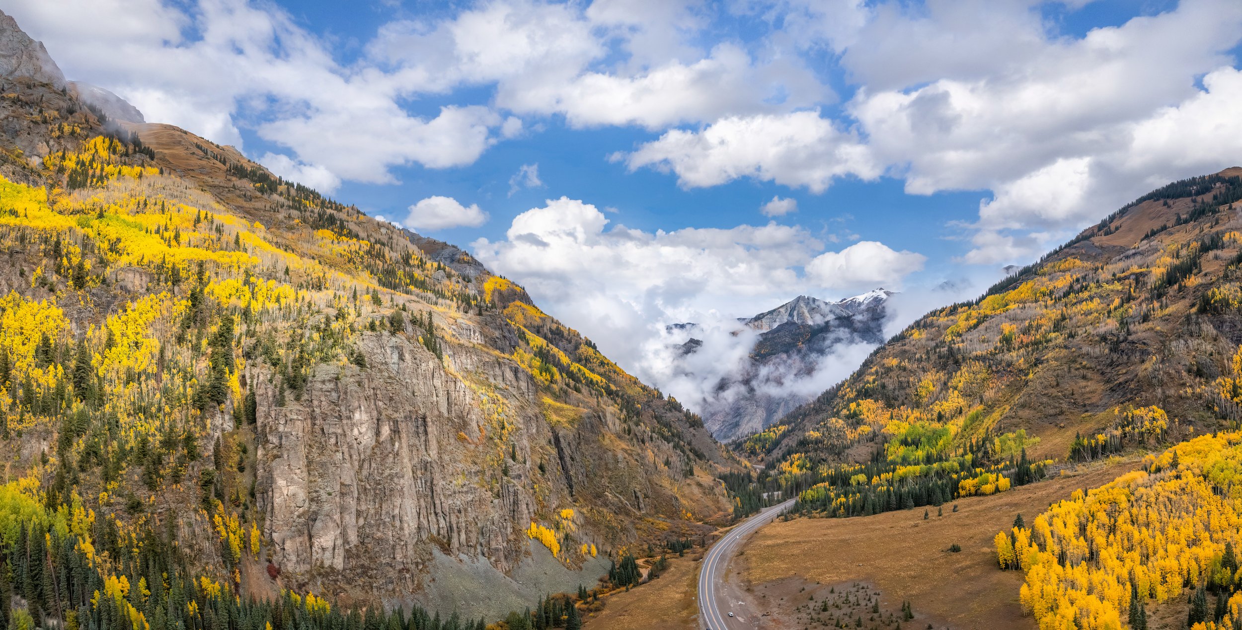
If you don't have time to enjoy the full San Juan Skyway, which takes 7 hours, you should at least enjoy the Million Dollar Highway to Silverton. The drive between Ouray and Silverton is breathtaking. There are plenty of "photo ops" so bring your camera!
Most guests are surprised that there are no guardrails on much of this highway. Having no guardrails allows the road to be plowed in the winter because the snow can be pushed off the edge. The Million Dollar Highway was an old toll road built in the 1880's by Otto Mears. Just beyond the pullout for Bear Creek Falls, 2 miles south of Ouray, Otto Mears set up his tollgate at the narrowest point in the "road", to collect his $3.75 from each "vehicle".
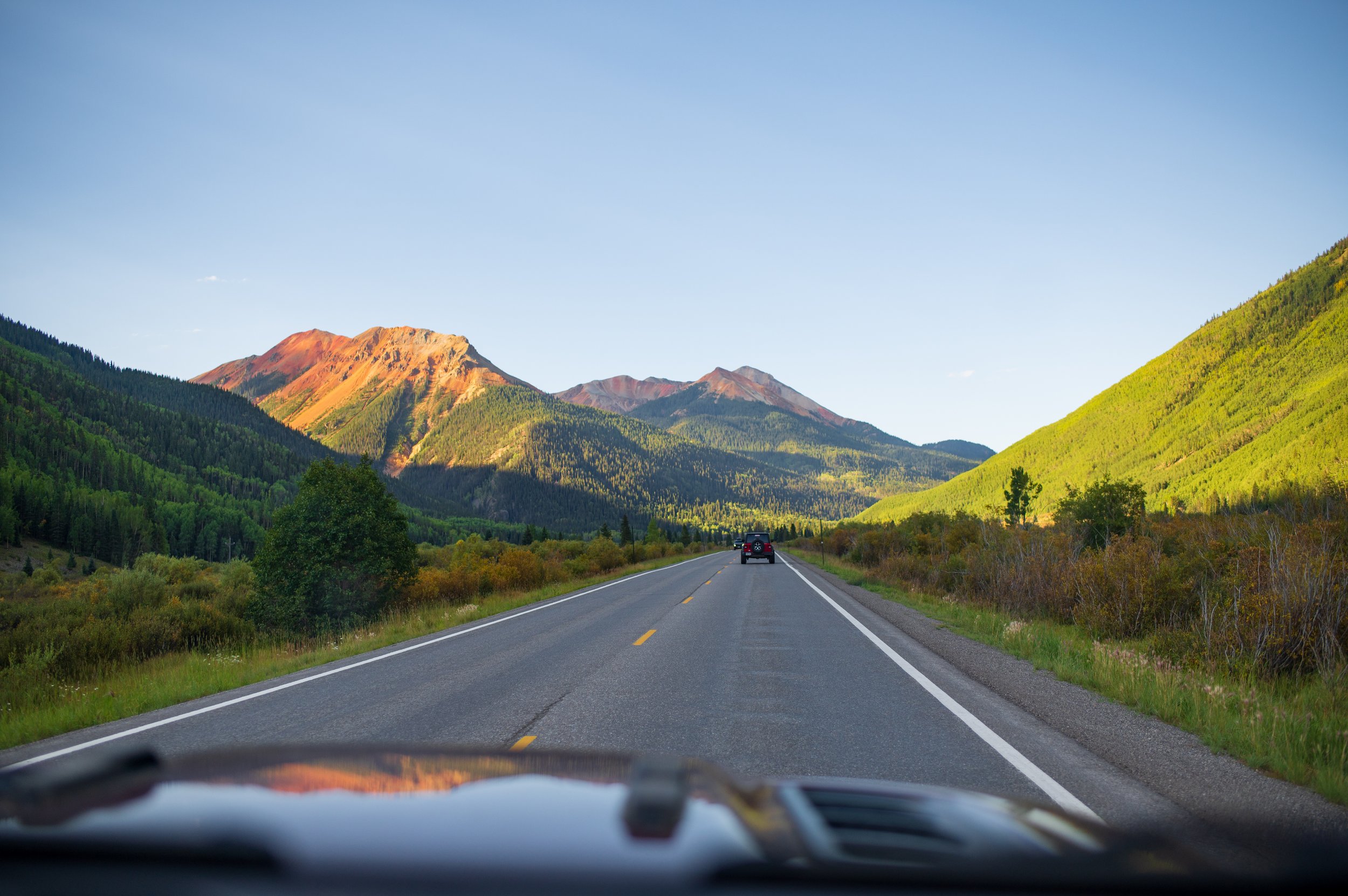
Red Mountains #1, #2 and #3, towering above Ironton Park, glisten in the sunshine in bright rust tones. This natural coloring is caused by the oxidation of the iron in the soil. Throughout this drive you will find the mountainsides dotted with old mines, weathered buildings and ore dumps. Millions of dollars in gold and silver were laboriously dug from these area mines. The Idarado Mine, located just on the Ouray side of Red Mountain Pass, closed down mining operations about 20 years ago. They are, however, continuing to work on land reclamation. This drive is spectacular both going and coming. As an extra treat, the trees in the fall are truly magnificent.
ROUND TRIP TIME: This round trip takes 2 hours, depending on the number of times you stop for photographs.
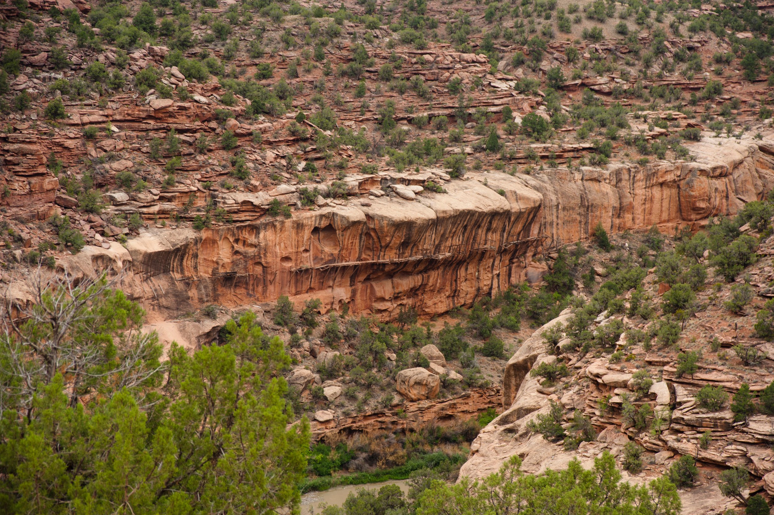
UNAWEEP-TABEGUACHE SCENIC AND HISTORIC BYWAY
This spectacular drive through the Unaweep Canyon to Uravan takes you through a land of contrasts from arid deserts to lush green valleys. There are many unique points of interest along this historic byway: Uravan, where 60% of the uranium that was used for the U.S.'s first atomic bomb was mined; the hanging flume, an engineering marvel which turned out to be a financial embarrassment and maintenance nightmare; East Creek and West Creek, two streams separated by a divide, each flowing in opposite directions; petroglyphs (rock art) attributed to the Uncompahgre people who inhabited the region from about 0 to 1300 A.D.
To start your trip through the canyon, drive north from Ouray and turn west at Ridgway onto Hwy 62. At the Placerville junction, follow Hwy 145 northwest through Norwood and Nucla. Just beyond Nucla, Hwy 141 turns north towards Uravan. Your canyon drive will end in Whitewater, a small ranching community just south of Grand Junction. Historical literature on the Unaweep Canyon and information on the above mentioned interest points is available at many of Ouray’s stores.
ROUND TRIP TIME: The scenic drive to Whitewater will take approximately 4 hours, not including stops. The return trip from Grand Junction to Ouray will take about 2 hours, driving south on Hwy 50 & 550.
San Juan Skyway Loop
This 7 hour, 232-mile loop can be a long day depending on how much you stop along the way. You'll be passing through Ridgway, Telluride, Cortez, Durango and Silverton. Each of these towns is unique, so allow some time for exploring each one. You can start out on the loop going either direction on Highway 550, south through Silverton and Durango or north and west through Ridgway and Telluride.
In determining your route, remember that you'll want to be driving between Ouray and Durango during the daylight hours. The San Juan Skyway encircles half of the largest mountain range in Colorado, includes ancient lands of the Anasazi and many of the most productive mining camps in the United States. This is one of the most scenic drives in America.
ROUND TRIP TIME: The full tour takes approximately 7 hours, without stopping. You may be interested in exploring Mesa Verde. It can take the better part of a day to visit the ruins themselves so don't try to include this stop in the round trip time.
The Ouray Visitors Center has a detailed Southwest Colorado map so stop by and request one. This map is very helpful in pinpointing the various attractions along the San Juan Skyway.
Photo by: @TravelingBitners
All Day Excursions
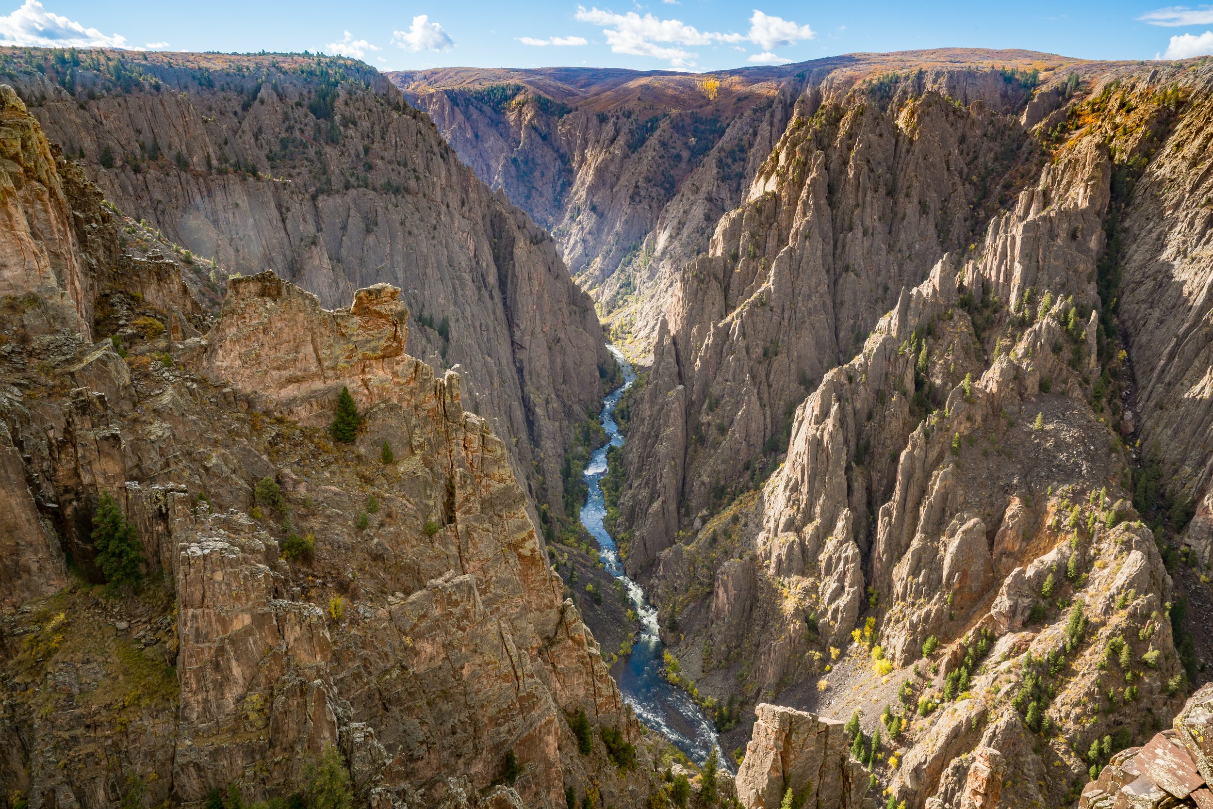
BLACK CANYON OF THE GUNNISON
It’s an easy drive from Ouray to the Black Canyon just 10 miles east of Montrose. No other canyon in North America combines the narrow opening, sheer walls, and startling depths offered by the Black Canyon of the Gunnison.
Stop at the outstanding Park Visitor Center and its overlook into the canyon. From there you can visit any number of the many overlooks which vary in walking distances or drive the rim and see the entire canyon.
Entrance to the Black Canyon is $15 for a non-commercial vehicle and $7 for pedestrians, bicycle, and motorcycles.
ROUND TRIP TIME: Ouray to the Black Canyon and back will take about 3 hours of driving, not including stops.
GRAND MESA SCENIC & HISTORIC BYWAY
Although this scenic drive is pretty throughout the summer season, the fall months, with the spectacular aspen colors is the prime time to make the drive.
Drive north from Ouray to Delta (1 hour) and turn east onto Hwy 92. Just east of Delta, you will be turning north onto Hwy 65 going toward Cedaredge. You will slowly tour upward to an altitude of 10,000 feet, first through the rolling hills of apple orchard country and then into the higher aspen groves. Be sure to look back as you rise in altitude since you have a magnificent view of the San Juan and Cimarron Ranges and the beautiful green valleys below.
The 530 square miles of the Grand Mesa makes it the largest flat-topped mountain in the country. The national forest is dotted with more than 220 lakes and streams. If you didn't pack your lunch in Ouray, be sure to stop in Cedaredge and get a picnic lunch to enjoy on the Mesa at any number of spectacular locations.
ROUND TRIP TIME: The trip over the Grand Mesa from Ouray will take approximately 2 1/2 hours. The return trip from Grand Junction to Ouray will take about 2 hours, driving south along Hwy 50 and 550.
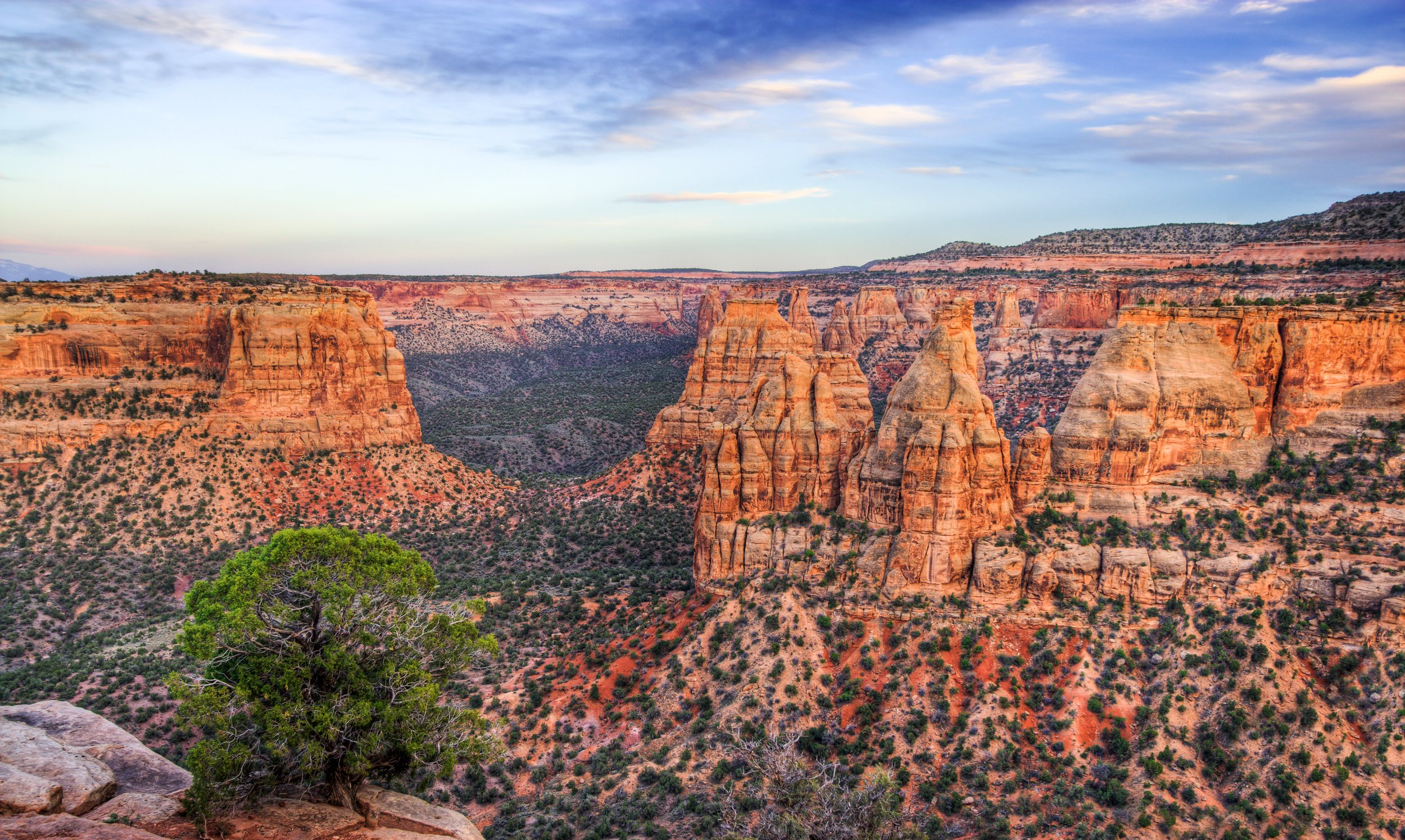
COLORADO NATIONAL MONUMENT- RIM ROCK DRIVE
Colorado National Monument was established in 1911 to preserve one of the grand landscapes of the American west. Along the 7-mile Rim Rock Drive, you'll see brilliantly colored, towering masses of naturally sculpted rock.
Along Rim Rock Drive, there are several short foot trails leading back into the canyons. There are also plenty of overlooks and two picnic areas with tables, charcoal grills, water and restrooms. To reach the entrance to the Colorado National Monument, drive north from Ouray on Hwy 550 & 50 to Grand Junction. When you reach Grand Junction, follow Hwy 50 north to the intersection of Grand Avenue (Hwy 340) and turn left onto Hwy 340. From there, follow the signs to Colorado National Monument to enter the park at the East Grand Junction Entrance.
The charge to enter the park is $10.00 per car and $5 for pedestrians, bicycles and motorcycles. The Visitor Center is about three-fourths of the way along the Rim Rock Drive. You will exit the park at the West (Fruita) Entrance onto Hwy 340. Turn south and follow Hwy 340 back to Hwy 50 and back south to Ouray.
Check for the Map and Guide for the Colorado National Monument at the Ouray Visitor Center or pick up one when you get there.
ROUND TRIP TIME: The scenic drive to the Colorado National Monument will take approximately 2 1/2 hours, not including stops. The return trip from Grand Junction to Ouray will take about 2 hours, driving south on Hwy 50 & 550.
Last Thoughts
The mountains surrounding Ouray provide some of the most spectacular scenery in the United States, much of which can be seen driving a regular passenger car.
Some drives suggested here are paved roads; some are dirt roads. At no time, however, will you need a four-wheel drive vehicle unless you go beyond the suggested route.
A free, detailed map of Southwest Colorado can be picked up at the Ouray Visitor Center. The following books are available for purchase at many of Ouray’s local shops: “Scenic Driving Colorado”, “San Juan Skyway”, “One Drive In A Million”, “Million Dollar Highway”, and Historical Touring Guide to the San Juan Skyway”.
Things to remember before starting out:
1) No matter which drive you take, be sure to take your camera. All of the drives have beautiful scenery worth capturing.
2) Please be cautious when driving and trying to admire the scenery. If you would like to take a picture please stop at one of the many turnoffs.
3) Watch carefully for various curve and road signs and adhere to the posted speed limits. Also, watch for wildlife, particularly deer. When there are signs warning of wildlife, be especially alert.